
5-19 weekend ride & hike pics


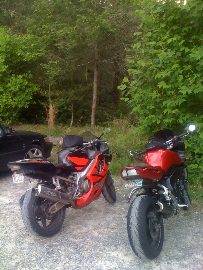
Once again, another awesome weekend! Unfortunately it'll probably be the last of our long all day excursions for a little bit, as Scotts parents are leaving this coming weekend for the whole summer, so he won't have anybody to watch his dog during the day, and we won't be able to stay out all day anymore. But anyways, we got a late start Saturday as Scott and I had to put a new A/C compressor in his moms car and get that working. Finished that, grabbed some lunch and then headed out by about 3:00 or so.
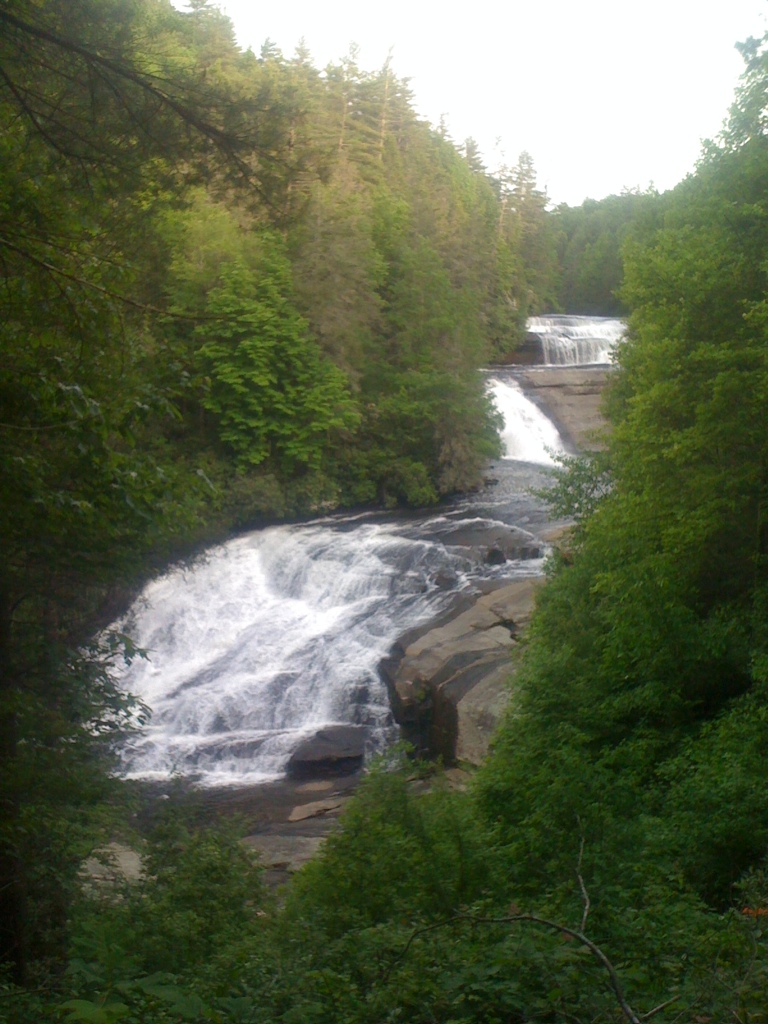
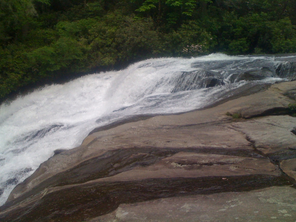
Ultimately we needed to end up in Greenville, SC by the days end to visit a buddy (I'll get to that in a minute), so we decided to wander around on some backroads and make our way down there and hit up a few waterfalls on the way. So we made our way over to the Dupont State Forest, where there's a whole ton of waterfalls, and made a stop at Hooker Falls
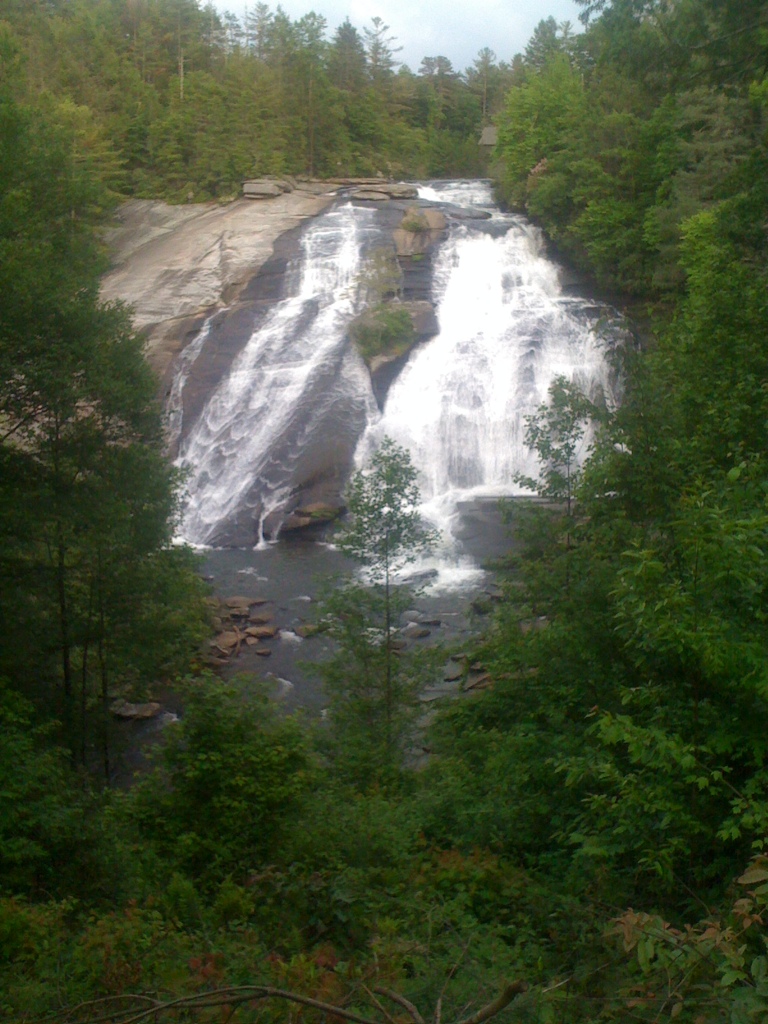
We head in and the first one along the way was Triple Falls
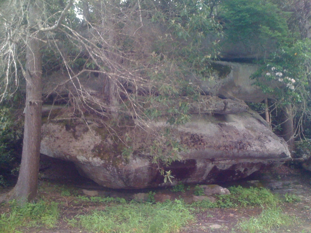
Went in a little further and did some exploring on the rocks
I still don't understand how a tree can grow out of a rock?? LOL
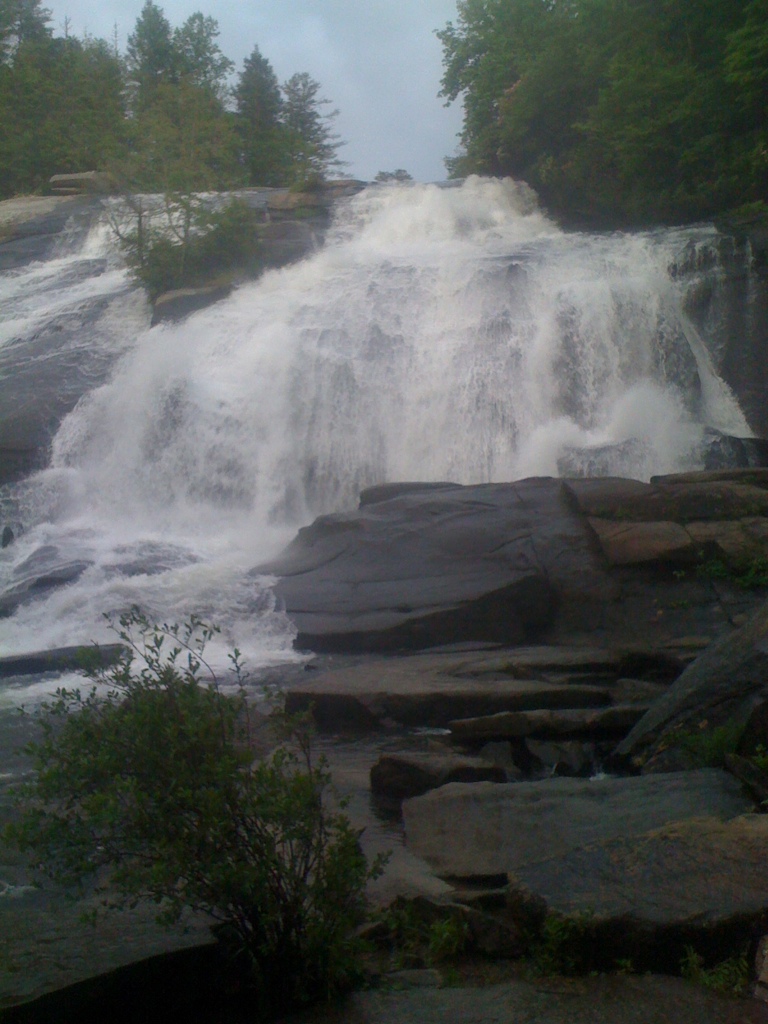
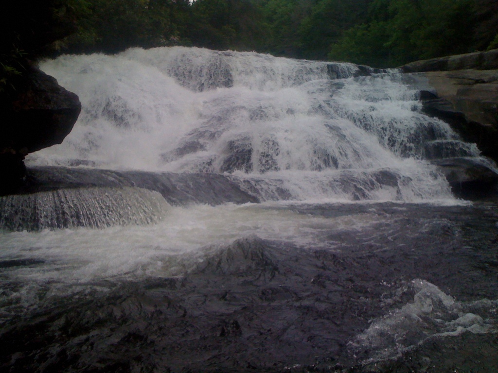
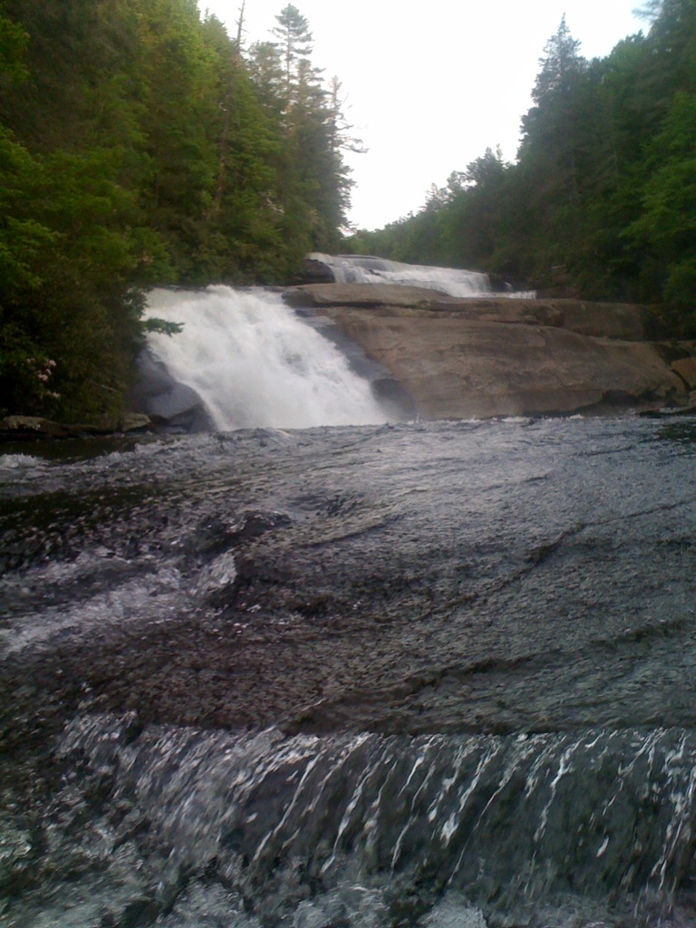
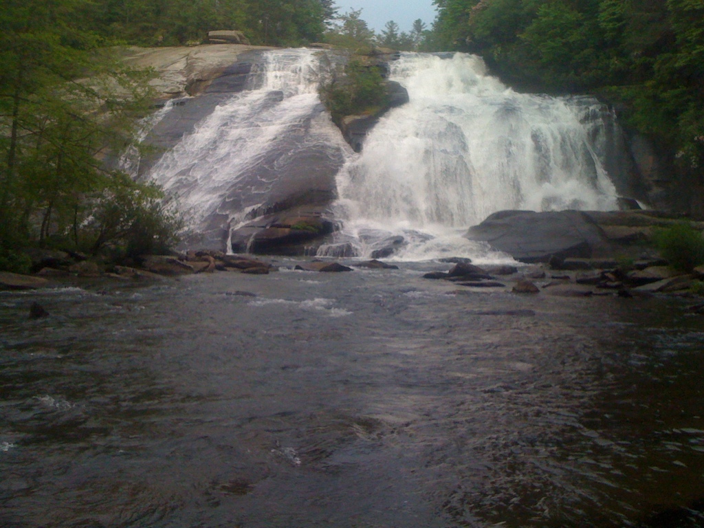
Next stop was High Falls..... it's 100ft fall but really doesn't look it
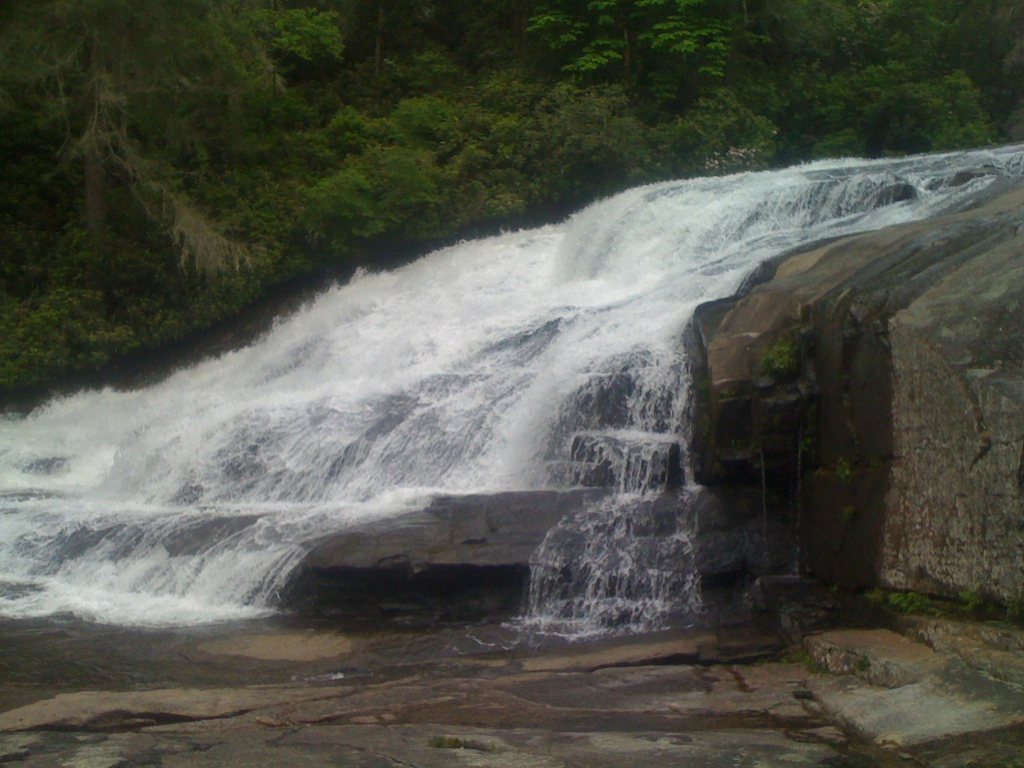
We kinda ventured off into the woods to get down to the bottom of the falls, and oddly enough under a bunch of fallen trees and whatnot, there's some old steps where a trail used to be that lead down to the bottom. After climbing over enough trees and rocks, we get to the bottom
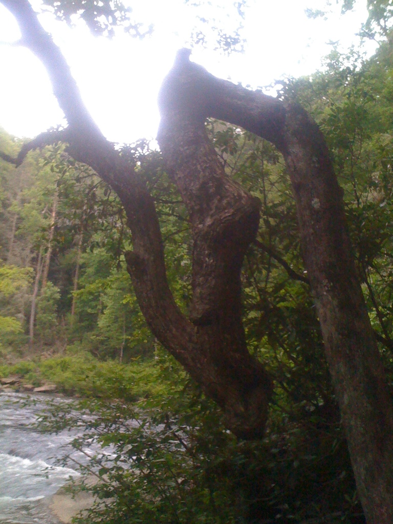
How does THAT happen?? LOL
It was getting late and starting to get dark, so we made our way back out of the woods and headed the rest of the way down to Greenville. We were gonna make a stop at Ceasars Head State Park on the way, but it was completely dark by that time so we just continued on into Greenville
We head over to the Barnes and Noble once we get into town, and meet up with this guy
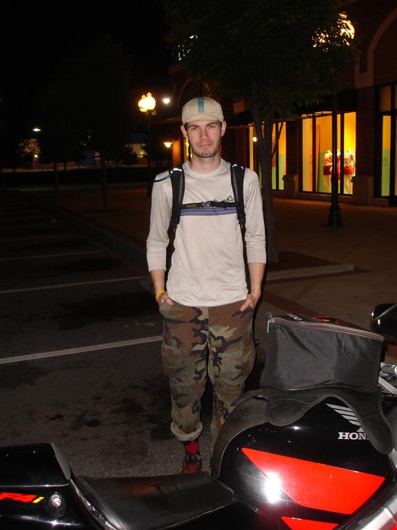
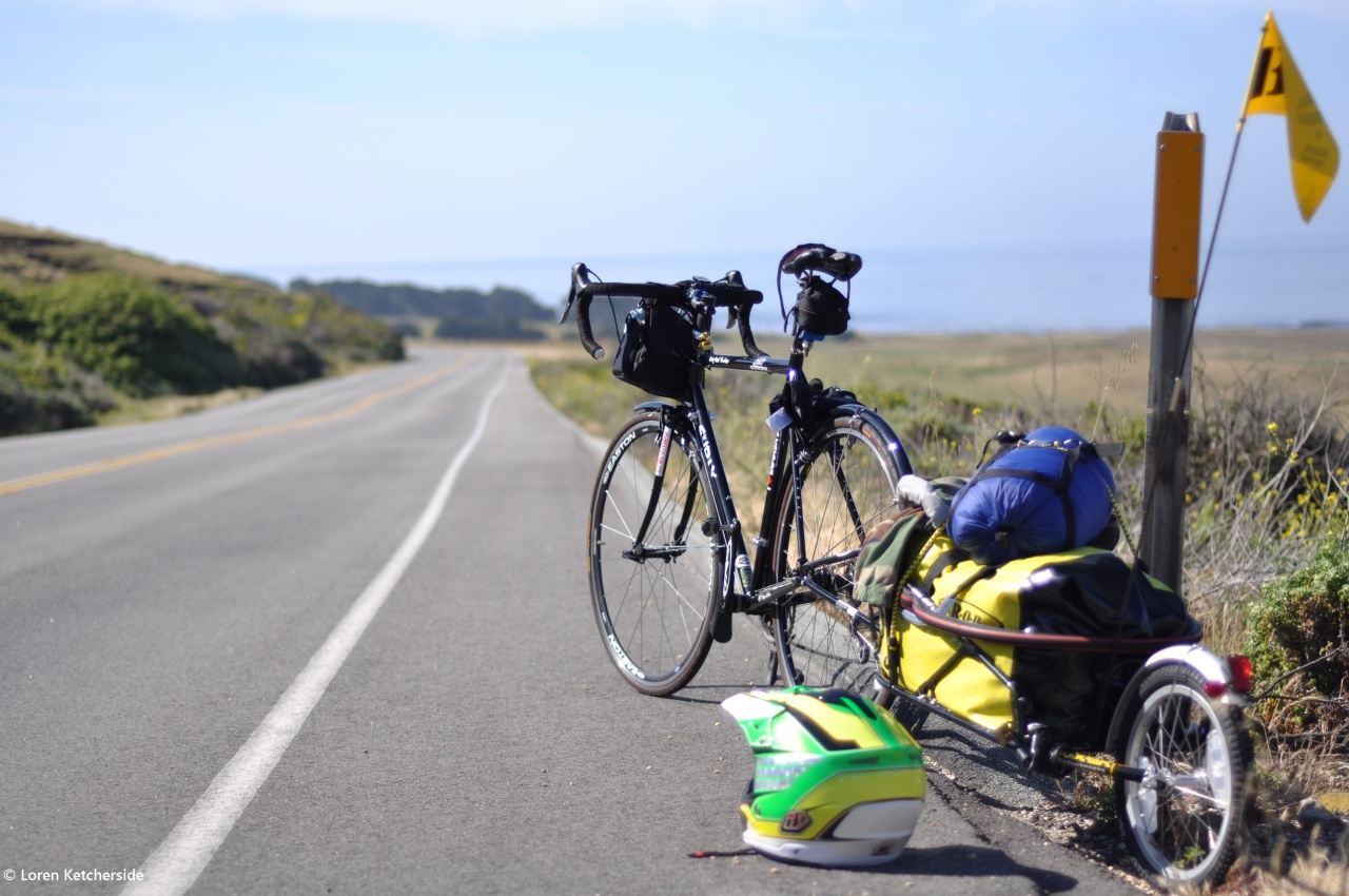
He's on a couple of the other forums I'm on.... he left May 21, 2011 from southern California on a 49 state BICYCLE tour. He was staying in Greenville, SC for the weekend so I had to run down and meet up with him. As of when I met him, he'd been through 38 states already and was heading up towards the NE after SC. He plans on finishing his trip in Boston, MA in a couple months, then getting on a train and heading home to Cali for a fresh start. It was awesome hearing him tell of his epic journey firsthand.... most definitely an adventure, that's for damn sure! This is one of his pics from along the way.... I couldn't get a decent pic of the bike and trailer at night
It was nearing midnight and we were all getting tired and needed some rest, so we decided to call it a night and make our way home. Stopped for some food and gas before we got back into NC (gas is about $0.30 higher in NC than in SC), and couldn't help but laugh at the idiot proof gas pumps, lol. Yup... here's your sign

Sunday morning we both wanted to get a little sleep, so we didn't head out until about 11:00 or so. We had a few hiking destinations in mind, so we made our way up NC 80 (a local favorite) up to the Blue Ridge Parkway
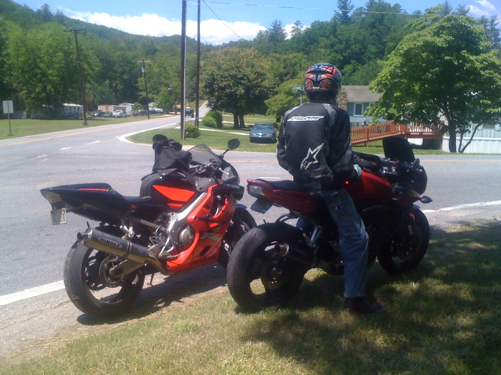
We go 100 something odd miles down the parkway (almost at the end) to our first destination.... Waterrock ****
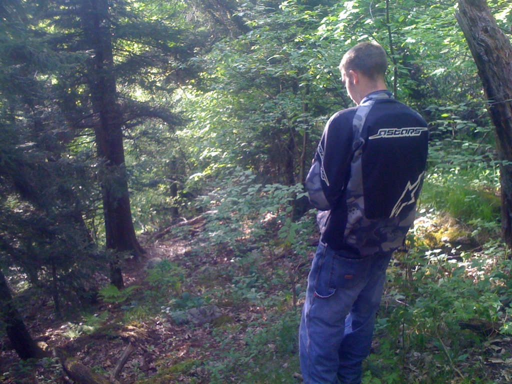
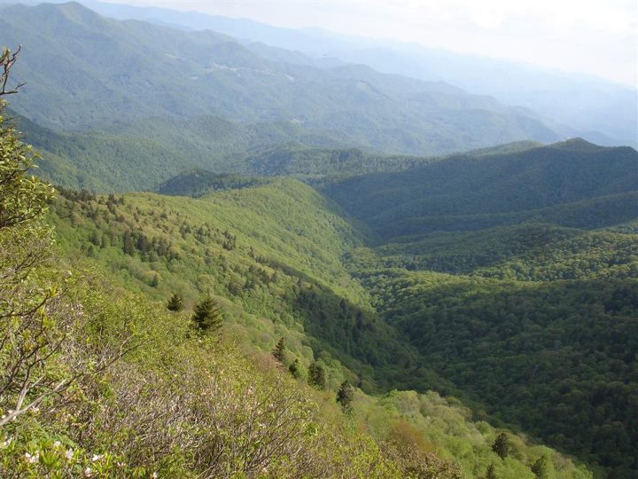
We make our way up the trail, which the actual trail is only 0.5 mile and really not a whole lot there. But we were on a mission..... somewhere on this peak, very close to where we were at, there was a crashed airplane that hit the side of the mountain back in 1983 and the plane is still sitting there deep in the woods to this day. So we were hoping to find it. Other hikers have found it before and and there was a rough un-heavily travelled 'trail' going off deep into the woods marked with orange tape on tree branches, so we head off and follow that. Long story short.... we never did find the plane, so we were both kinda bummed about that. But there were some incredible views along the way that you'd never see along the regular trail
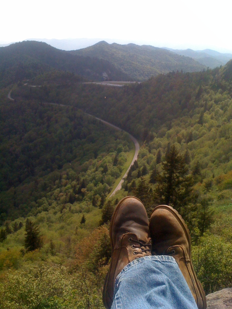
That's a sheer drop off right in front of that tree
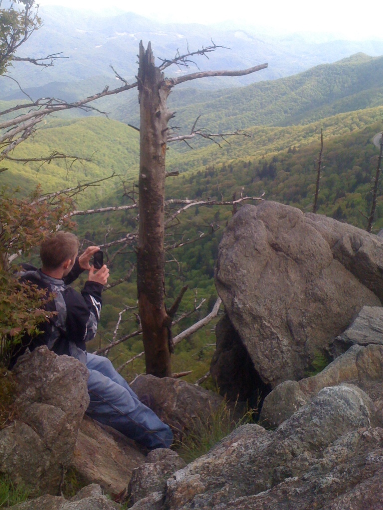
The pictures (especially crappy quality ones at that, lol) do these views absolutely no justice whatsoever.... not even close
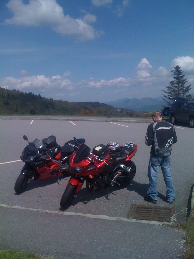
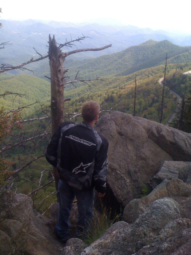
That parking lot you see in the background is where our bikes were parked.... we hiked up the ridge in the right of the pic. This was towards the beginning of the hike too, we kept going much further back
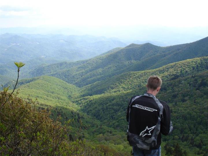
As you can see though, we've definitely got a pretty rough life, hahah
A few spots where we pretty much were blazing our own trail... climbing over rocks and trees, through bushes, etc
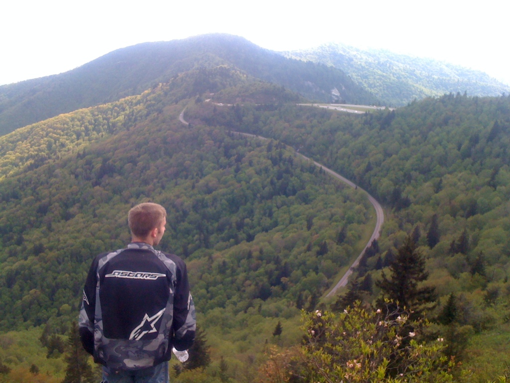
It was getting later in the day, the sun would soon be going down and we were still in the middle of the woods, so we decided we had to start heading back. We knew we weren't far from the Parkway (road) as the ridge we were hiking along pretty much parallels the road, just much higher up. We continue along and, oddly enough, end up at a house of some sort up on the peak of the mountain. It didn't look like anybody was there, so we go up hoping to find a driveway. There was a grassy path leading down, so we took it. It lead a ways down to a gate, went around and there was a gravel road and several more houses along there (we saw these houses earlier in the hike waaaaaaaaay in the distance, just didn't know we'd pop out there, lol). We continued down this road for a little ways, then after pulling out a map and figuring out where we were, saw that this road went down close to the parkway, but not to it. So we'd once again have to cut our own path through the woods. So there was a house there that was still being built, and our closest route to the parkway was gonna be right through their yard and into the woods. So we venture down this insanely steep decent hanging onto trees and whatnot and hobbling over rocks. We finally make it down to the bottom and pop out right on the parkway. Luckily we went the way we did, as if we would have gone about 50-100 feet to the right coming down, just before the road it was a sheer drop off rock wall.... phew! So now we just walked along the parkway for 2.5 miles to get back to the parking lot
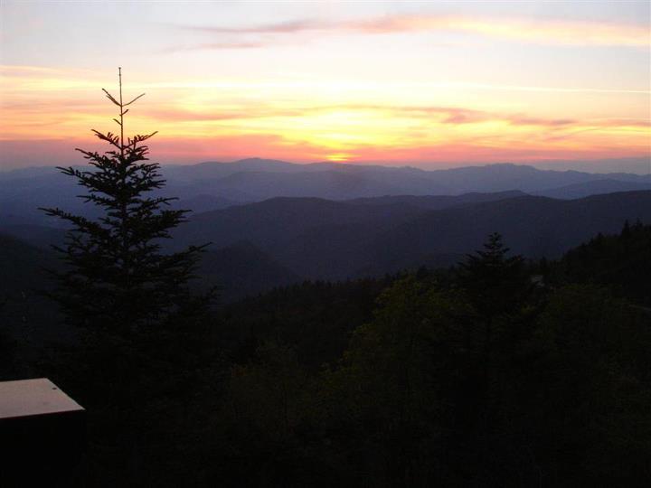
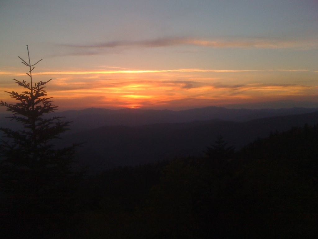
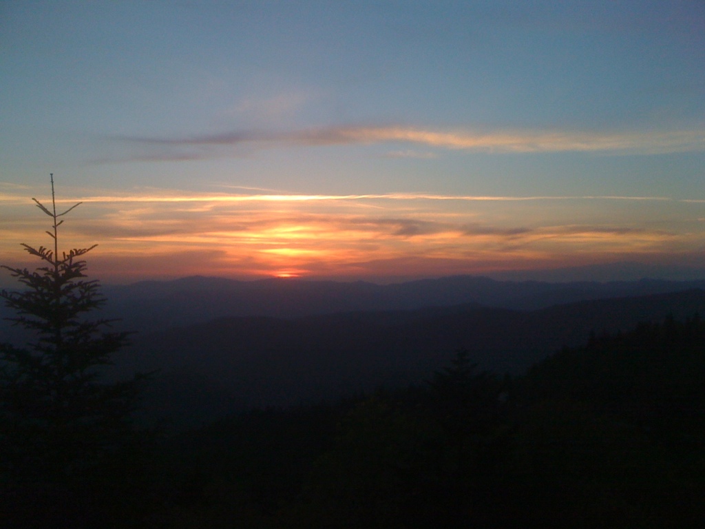
We estimate that we hiked a total of about 12 miles, on some very rough 'trails', lol..... lots of steep up's and down's, climbing over big rocks and trees, etc. So needless to say, we were tired. I gulped down an entire bottle of water, and we had made it just in time before it got dark and were able to catch an awesome sunset (perfect spot for it)
We headed out and went down the rest of the parkway to where it ends (or starts, depending) in Cherokee, NC. It was almost 10:00 pm by this point, we were both beyond starving and still 2 something hours from home. So we filled up with gas in Cherokee, got some food, then made our way back home. Got home a little before 1:00 am, totally sore and tired, and proceeded to pass the hell out, hahah. It didn't feel like it, but even with the late starts and hiking, we still did right at 500 miles for the weekend, so not too bad
And this is the plane we were after..... I didn't take the pic of course since we never did find it, but it's there.... somewhere

And a little background behind the crash..... "November 24, 1983, a Cessna 414A flying from Chicago with a destination of Sylva, NC crossed over the Snowbird VOR at an elevation of 6700 feet, then turned south and made several "up and down excursions in altitude". Last known altitude was 6100 feet about a mile from the crash site. The crash site is stated as about 11 miles from the destination. It was a night time flight with low clouds and percipitation. Two people on board, both fatalities. The pilots blood alcohol content was 0.04%. The pilot was 53 years old. Time of accident was 17:55 EST."
As always, we both had a fantastic time!
Ultimately we needed to end up in Greenville, SC by the days end to visit a buddy (I'll get to that in a minute), so we decided to wander around on some backroads and make our way down there and hit up a few waterfalls on the way. So we made our way over to the Dupont State Forest, where there's a whole ton of waterfalls, and made a stop at Hooker Falls
We head in and the first one along the way was Triple Falls
Went in a little further and did some exploring on the rocks
I still don't understand how a tree can grow out of a rock?? LOL
Next stop was High Falls..... it's 100ft fall but really doesn't look it
We kinda ventured off into the woods to get down to the bottom of the falls, and oddly enough under a bunch of fallen trees and whatnot, there's some old steps where a trail used to be that lead down to the bottom. After climbing over enough trees and rocks, we get to the bottom
How does THAT happen?? LOL
It was getting late and starting to get dark, so we made our way back out of the woods and headed the rest of the way down to Greenville. We were gonna make a stop at Ceasars Head State Park on the way, but it was completely dark by that time so we just continued on into Greenville
We head over to the Barnes and Noble once we get into town, and meet up with this guy
He's on a couple of the other forums I'm on.... he left May 21, 2011 from southern California on a 49 state BICYCLE tour. He was staying in Greenville, SC for the weekend so I had to run down and meet up with him. As of when I met him, he'd been through 38 states already and was heading up towards the NE after SC. He plans on finishing his trip in Boston, MA in a couple months, then getting on a train and heading home to Cali for a fresh start. It was awesome hearing him tell of his epic journey firsthand.... most definitely an adventure, that's for damn sure! This is one of his pics from along the way.... I couldn't get a decent pic of the bike and trailer at night
It was nearing midnight and we were all getting tired and needed some rest, so we decided to call it a night and make our way home. Stopped for some food and gas before we got back into NC (gas is about $0.30 higher in NC than in SC), and couldn't help but laugh at the idiot proof gas pumps, lol. Yup... here's your sign
Sunday morning we both wanted to get a little sleep, so we didn't head out until about 11:00 or so. We had a few hiking destinations in mind, so we made our way up NC 80 (a local favorite) up to the Blue Ridge Parkway
We go 100 something odd miles down the parkway (almost at the end) to our first destination.... Waterrock ****
We make our way up the trail, which the actual trail is only 0.5 mile and really not a whole lot there. But we were on a mission..... somewhere on this peak, very close to where we were at, there was a crashed airplane that hit the side of the mountain back in 1983 and the plane is still sitting there deep in the woods to this day. So we were hoping to find it. Other hikers have found it before and and there was a rough un-heavily travelled 'trail' going off deep into the woods marked with orange tape on tree branches, so we head off and follow that. Long story short.... we never did find the plane, so we were both kinda bummed about that. But there were some incredible views along the way that you'd never see along the regular trail
That's a sheer drop off right in front of that tree
The pictures (especially crappy quality ones at that, lol) do these views absolutely no justice whatsoever.... not even close
That parking lot you see in the background is where our bikes were parked.... we hiked up the ridge in the right of the pic. This was towards the beginning of the hike too, we kept going much further back
As you can see though, we've definitely got a pretty rough life, hahah
A few spots where we pretty much were blazing our own trail... climbing over rocks and trees, through bushes, etc
It was getting later in the day, the sun would soon be going down and we were still in the middle of the woods, so we decided we had to start heading back. We knew we weren't far from the Parkway (road) as the ridge we were hiking along pretty much parallels the road, just much higher up. We continue along and, oddly enough, end up at a house of some sort up on the peak of the mountain. It didn't look like anybody was there, so we go up hoping to find a driveway. There was a grassy path leading down, so we took it. It lead a ways down to a gate, went around and there was a gravel road and several more houses along there (we saw these houses earlier in the hike waaaaaaaaay in the distance, just didn't know we'd pop out there, lol). We continued down this road for a little ways, then after pulling out a map and figuring out where we were, saw that this road went down close to the parkway, but not to it. So we'd once again have to cut our own path through the woods. So there was a house there that was still being built, and our closest route to the parkway was gonna be right through their yard and into the woods. So we venture down this insanely steep decent hanging onto trees and whatnot and hobbling over rocks. We finally make it down to the bottom and pop out right on the parkway. Luckily we went the way we did, as if we would have gone about 50-100 feet to the right coming down, just before the road it was a sheer drop off rock wall.... phew! So now we just walked along the parkway for 2.5 miles to get back to the parking lot
We estimate that we hiked a total of about 12 miles, on some very rough 'trails', lol..... lots of steep up's and down's, climbing over big rocks and trees, etc. So needless to say, we were tired. I gulped down an entire bottle of water, and we had made it just in time before it got dark and were able to catch an awesome sunset (perfect spot for it)
We headed out and went down the rest of the parkway to where it ends (or starts, depending) in Cherokee, NC. It was almost 10:00 pm by this point, we were both beyond starving and still 2 something hours from home. So we filled up with gas in Cherokee, got some food, then made our way back home. Got home a little before 1:00 am, totally sore and tired, and proceeded to pass the hell out, hahah. It didn't feel like it, but even with the late starts and hiking, we still did right at 500 miles for the weekend, so not too bad
And this is the plane we were after..... I didn't take the pic of course since we never did find it, but it's there.... somewhere
And a little background behind the crash..... "November 24, 1983, a Cessna 414A flying from Chicago with a destination of Sylva, NC crossed over the Snowbird VOR at an elevation of 6700 feet, then turned south and made several "up and down excursions in altitude". Last known altitude was 6100 feet about a mile from the crash site. The crash site is stated as about 11 miles from the destination. It was a night time flight with low clouds and percipitation. Two people on board, both fatalities. The pilots blood alcohol content was 0.04%. The pilot was 53 years old. Time of accident was 17:55 EST."
As always, we both had a fantastic time!


Thread
Thread Starter
Forum
Replies
Last Post
thirdgenlxi
Sights 'N Sounds
5
Sep 13, 2010 05:36 AM
thirdgenlxi
Sights 'N Sounds
11
Jan 29, 2008 09:33 PM